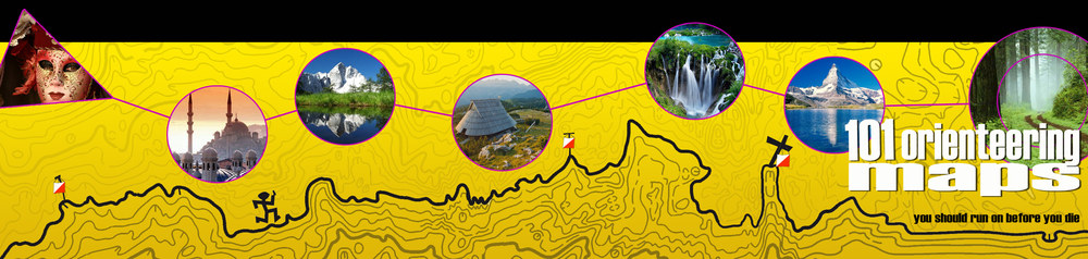
101 Orienteering Maps you should run on before you die!

Some of these maps might make it into the final list of the 101 Orienteering maps you should run on before you die.
With so many magnificent orienteering destinations, it sounds a bit like a mission impossible to select the 101 Orienteering maps you should run on before you die. Yet, we have now started this mission – and you will be able to both follow and shape the list on this blog. We will surely need the help of our readers all over the world in order to get a good result!
… most of all we want to enjoy the process of determining those 101 maps
Our ultimate goal, to produce a real paper book about 101 orienteering maps which every orienteer should run on before he/she dies is clear, but not set as a “101% must”. It depends on many people and circumstances how the project will develop. We will of course do our very best to complete it, however most of all we want to enjoy the process of determining those 101 maps.
101 Orienteering Maps Blog
The “101 orienteering maps” blog was started by Jan Kocbach & Ivan Nagy with the general aim to open a discussion not only about the most outstanding orienteering areas of the world – but also about different aspects of orienteering maps, mapping and to some extent about the essence of the sport itself. We have both had the idea for a long time, an idea which was sparked again after reading a story at OPN.no a few weeks ago.
In the map presentations here on the blog, we will go beyond the map itself - and also try to present pictures from the terrain and area and interesting information related to the maps. In some cases we will also present an interesting leg or a course on the map. Expect much more of this additional information in the final paper book – when we, hopefully, get there. A map being presented on the blog is no guarantee that it will make it to the final list.
chemotherapy nausea remedies http://mrkinjo.com/cialis-pfz.php african herbal remedies
online xanax pharmacy http://mrkinjo.com/viagra-pfz.php orange health care

Pictures from some of the terrains that might make it into the final list. Both in the blog and in the book we will present pictures from the terrain. When an orienteer gets a map and a picture, it is nearly like being there...
How to get on the list?
The first question that pops to your mind when seeing the title of this project, is surely which criteria we plan to use to determine the 101 maps. We have put a lot of thought into this question, and this is surely one question where we will need YOUR input. Here are some of the criteria we plan to use:
- Maps which have a characteristic terrain type or vegetation type which you will not find in many places. Of course, in many cases there will be several maps of similar terrain type. In this case, other criteria will be important (including the ones listed below).
- Maps may be chosen because they have a special history attached to them.
- The nature and surroundings of the map will surely be important along with the other criteria. One of the most special experiences as an orienteer is to orienteer in an area where magnificent views make it nearly impossible to concentrate on the map.
- In some cases, geographical position might be a criterium to choose a map.
- Some maps might be chosen due to a special competition being held on the map.
- Navigational pleasure – that is how much fun it is to navigate on the map. This is probably one of the most subjective criteria – very difficult to define – and thus this might give some interesting discussions. However, we think that the pleasure you get from moving through the terrain, taking in the forest and scenery while reading the map, should still be one of the most important criteria to get on the list.
Win your free copy of the book!
The first map will be presented tomorrow – from then on we will present maps with irregular intervals. The first person who manages to guess which map will be presented as the first map tomorrow – and adds it to the comments below – will get a free copy of the final paper book (assuming that we reach our goal and get the book to final print). Note that anyone affiliated with the map owners of the first map, who have been contacted ahead of this first map presentation, can not win.
Help us with your Feedback
Your help is highly appreciated. Use either the Feedback-button to the very right of the webpage, our Facebook-page or comments to the blog-posts to suggest maps and discuss our choices.
Which criteria do you think should be used to determine the 101 Orienteering Maps you should run on before you die? Have you got any suggestions about maps which should be on the list?
My guess for tomorrows map is the Venezia map. That’s surely one you should run on before you die!
Good choice – it’s definitely on my personal list. Wait until tomorrow to see if you got our first presentation right… (for those who haven’t seen the map – it is in omaps.worldofo.com here http://omaps.worldofo.com/index.php?id=13965 )
So many come to mind, I wonder which will get the honour of being the first one chosen. I suppose it’s only one guess per person, otherwise I could list a bunch of maps here… I’m guessing the Städjan map at Idre fjäll will be the one tomorrow – that’s a map you should run before you die!
Also one on my personal list – you’ll wait until tomorrow to see if it is the one getting the honour :)
Sounds like an interesting project! Who will be the first one, running on all these maps?
A map that surely will be on the list and my guess for the one presented tomorrow is Bot Fiena Trin where the Middle Final of WOC 2003 was held!
A fantastic terrain, indeed. I really like that area. And it is on my personal list as well (for those who haven’t seen the map, it is here http://omaps.worldofo.com/index.php?id=9755 ). You’ll have to wait until tomorrow to see if it is the one presented first, though…
A map that you should run on before you die is surely the Map Hellerberg in Dresden, Germany. Here you got an idea what terain is like:
http://www.osv-dresden.de/dmm07/dm_he.jpg
And another on is surely the map Trassenheide on the beautiful Island of Usedom. Sand dune terain. There was a former munition fabric on these terain…
http://www.ol-wiki.de/images/thumb/9/99/Weltrekord_Vielposten-OL_Usedom_2006.jpg/800px-Weltrekord_Vielposten-OL_Usedom_2006.jpg
Thanks for the input, Christian. I’ve seen both maps, but didn’t think about them for the list of the 101 Maps until now. I will put them on the list of maps to be considered.
Christian, do you happen to know how was the negative relief of the Hellerberg map formed? Is it natural or artificial? Reminds me a bit of some military areas …
The Hellerberge Areal is an old military training place and included also the first airport in Dresden in the south of the map. But it has not been in military useage since 30 years. And it is also a nature reservoir now.
What a great idea!
I’d like to see that a beautiful (and special?) layout would count for a map to be presented among the 101. And how the map itself are drawn (nice, continuous curved lines are preferred!). And in some extent that the IOF map standards have been followed.
Three favourite maps among many others, are:
– the 1985 WOC map of Bendigo, Australia.
– the 2002 PWT map of Matera, Italy.
– the 2006 WC final map of Clermont Ferrand, France (My guess for tomorrow is this one).
Best wishes for the project!
Thanks for the useful comment Tore. How the map is drawn should definitely be one of the criteria. It can be a real (artistic) pleasure to just look at some masterfully drawn map (of some preferably interesting area).
All the maps you mentioned we are thinking about! But which one will be THE one tommorow, we will see :).
The first map? What about the map (terrain) where the first public orienteering was held in 1897 in Norway.
Hm, good, senseful try, Ales. Maybe, maybe … :). Let’s see tommorow.
One of the maps I thinkwill be elected is a map from WOC of Japan
http://omaps.worldofo.com/index.php?id=9745
or the Sprint map from Geneve
Interesting choice. Some maps from Japan will be presented on our blog and quite likely also in the book. Can’t say yet if your guess for tomorrow’s pick is correct.
The first map is going to be legendary Clermont-Ferrand. That´s for sure! ;)
He, he, sure is nothing in this world, Nurci! Well, that’s for sure! ;)
An option for tomorrow are also maps in the pine forrest at the Costa Blanca near Alicante in Spain, where 2002 the JWOC was held on.
My favourite: Guardamar Sur, JWOC Middle Final
http://3.bp.blogspot.com/_m1jdvxN0450/SZrLtoUwnII/AAAAAAAADnE/LJEjRRSehKo/s1600-h/middle_JWOC2002_alessio.jpg
Thanks Philippe, it’s a good choice. It was already on our internal list!
Also high on my list – I loved running there some years ago!
Got to be the Trossachs in Scotland: http://omaps.worldofo.com/?id=5793
However I would rate Tiha Dolina http://omaps.worldofo.com/index.php?id=325 and of course Venice!
Trossachs is great, could be the first one.
Tiha dolina? Hm … one of the blog founders happens to be tightly connected to this map :). So, seems to be wise guess … We’ll see. Thanks for comment.
OO.cup 2002 2nd stage..don’t remember the name of the map, but the terrain was awesome! That’s my guess
Rasmus, that was the legendary Štonah map on Soriška planina. Indeed, one of the “craziest” mapped areas and one of my personal favorite maps … Nice choice and let’s see tomorrow if it’s the first one.
I would definitely suggest Irbene map – the terrain of Long distance from European Champaionships 2008 (Latvia): http://www.orient.lv/kartes/2008/896_irbene.jpg
This map contains every imaginable terrain requiring so many different orienteering tehniques in a single race. You have to adjust your orienteering style constantly as you run. There’s a very runnable forest, mixed with lots of marshes and bogs of different passability. There are big topographic forms mixed with very detailed relief. There are grassy meadows in the southern part of the map and on top of it all – a big sand desert in the middle. This map is a challenge! But a pleasent one at that.
This was one of the first maps on my mind and on our list. It really seems great and runners’ comments were also great. However, note that the first map is by no means meant as a map which “most deserves” to be in the book. To my thinking such a map/terrain does not exist! The first area is one of quite a few, which are simply – great! :)
I guess map would be from Long distance Nordic Orienteering Championship 1984 Tromssa Norway. Somebody has said that it has been the best orienteering terrain ever. I have never been there but want to visit.
I’ve never been there either, but I had it hanging on my wall for more than 10 years. It is surely one of the maps I want to run on in my lifetime (and I’m quite sure I’ll get there as well). Actually, it is a nice project to try to run on all the maps that make it into the final list:). If th NOM-84 map is the map that will be published tomorrow, we’ll have to wait and see…
BTW, the NOM 1984-map in question can be found here in omaps.worldofo.com: http://omaps.worldofo.com/index.php?id=7239
The map from from the Nordic championship in 1984 in Balsfjord (approximately 100 km from Tromsø) is fantastic. But whats most fantastic is the terrain. Is like a golf-field. In 2011 Midnattsolgaloppen (www.mg-norway.no), the largest orienteering-event in Northern Norway, will have 3 of 4 races on the actual map in Balsfjord. Come and try it!
You are the 5th person mentioning the NOM-84 map, so it seems like it is a map which it will be difficult not to include:) Might actually try Midnattsolgaloppen again in 2011 – some years since last time I was there.
When I wrote “golf-field” I meant the terrainbottom. You can run “with your eyes closed” without beeing afraid to get footinjuries. The map and the terrain should be an “obligatoric” experience in any orienteers life :-)
My guess is the map used for NOM 1984, in Aursfjord, Norway. http://omaps.worldofo.com/index.php?id=7239
It has been selected to the world’s best orienteering map.
Hi Peder, your comment for some reason ended spam folder. Now it’s rehabilitated :) and positioned as was posted. Thanks for the good suggestion, please see Jan’s reply one comment above.
Heee… I was about to mention this one (NOM 84!) :-(
Let’s try the WOC 1993 long distance in Harriman Park/US
Francois, thanks, both of these two “classics” will definitely be presented. One of them maybe already tomorrow :)! Let’s see.
The map of the JEC Longdistance in 2009 in the sanstone labyrinths
Lampertstein map is nice technical area … Presented tomorrow??
My guess/input is the map of the Ilulissat area in Greenland. Very rocky and broken, no vegetation higher than 20cm and no depressions (all are filled with water) and a _lot_ of ice in the ocean. The full map is 40+km2. A part of it can be seen here: http://iog.9net.dk/images/Ilulissat-Pitoqqeq.jpg
Very good choice, Kell! I can tell you so much that it is on our internal list – and also one of the maps I’d really want to run on. But I still won’t give away if it is the map to be presented tomorrow…
BTW: Thanks everybody for all the comments/guesses – keep them coming! It is really inspiring to get all this feedback – and it will also be valuable in our work determining the maps which deserve a place on the final list.
what about Passo Rolle, where the jwoc long final took place last year? Stunning landscape just at the feet of the Dolomites..
I have to admit that the Passo Rolle map was not yet on our internal list (there are other Italian maps, though:), so this is not the one which will be published tomorrow. However, I’ve been running at Passo Rolle, and it was really breathtaking – and interesting orienteering as well. We’ll but it on the consideration list. Thanks!
BTW, here is the map in omaps.worldofo.com: http://omaps.worldofo.com/index.php?id=14151
Leinstrandmarka in Trondheim.
This area (two Leindstrandmarka maps embargoed for WOC2010 – http://www.woc2010.com/GamleKart/Leinstrandmarka-vest.pdf and http://www.woc2010.com/GamleKart/Leinstrandmarka-oest.pdf ) wasn’t on our internal list, either. I’ll add it to our list of maps to be considered now, though. In your opinion, what are the special features for this map compared to other maps in the area? I’ve been both in Leinstrandmarka and on other maps in the area, and I can’t remember that Leinstrandmarka stood out a lot compared to some of the others, but I guess I might have forgotten something …?
I haven’t being there (truthful response). I just thought with the eyes on WOC you might start this 101 maps project off with that map.
I think beautiful surroundings count quite much, but terrain should be runnable and technically challenching too. To be ranked higher than “basic maps” there should be some speciality(geological formations, special place of intrest and so on). From my favorites that haven´t mentioned here previously Trockener Steg-Klein Matterhorn map from Swiss o-week 2006 could be my guess for tomorrow. Detailed bare-rock terrain that was under glacier just about thousand years ago and it is over 3000m above sealevel just under wellknown Matternhorm peak.
Tockener Steg-Klein Matterhorn is a very nice map – unfortunately I did not get the chance to run there (yet). And yes, it is on our internal list of maps to be considered. You’ll see tomorrow if it is the first one from our list to be presented… The list is growing – thanks for all the comments!
Regarding the criteria: Yes – in my opinion it should be more than “only” beautiful surroundings. We’ll invite you to more discussions on the criteria later on – specifically when we start presenting the maps.
My guess for tomorrow and one of my own all-time favourites is Ullahau -map in Fåro (Gotland). Very technical sand-dune terrain with beautiful views and also physically demanding because of sand. Place is also interesting itself. An little island in the sea between Sweden and Finland.
[...] ceremonial counties, and the Attackpoint 51 which does the same for US states, WorldOfO has launched a campaign to build a list of the top 101 unmissable orienteering maps around the world. It’s a [...]
Thanks for a nice article over at Yep sport, Oliver – with good input. In particular also an interesting discussion about how to choose the maps to be included. We’ll get back to the criteria in later posts. Just a small clarification, though: This is not a WorldofO-campaign, but rather a joint project by Ivan and me. And a project I think we’re both going to enjoy a lot :-)
Trockener Steg from SOW 2006 in Zermatt. orienteering at 3000m asl
http://www.mapsurfer.com/gadget/cgi-bin/reitti.cgi?act=map&id=31&kieli=
WOC 1993 West Point USA long distance
jan, you’ve already posted it among your maps :)
http://www.orientering.dk/julekalender06/woc1993e.jpg
Guardamar, WOC 2002 Spain
http://omaps.worldofo.com/index.php?id=15715
All three are already on our internal consideration-list:) All excellent choices – and all maps which I’d like to run on (I’ve only got Guardamar so far). We’ll see tomorrow of one of them is the one we gave the honor of the first presentation…
http://osprint.ee/100kp/2008/kaardid/koik.jpg – semi-open terrain with micro-reljef and a lot of trenches.
Looks very nice – not on our internal list, yet (but we’ve noted it down now). Does this map have any special features making it stand out compared to other maps in the area? Or is it the terrain type which is special?
I guess it was a rocket polygon during the soviet union’s time. Because of that there is that open area without forest and that’s unique. There is quite sqenic view also (http://static.panoramio.com/photos/original/23417159.jpg). There are competitions rarely. Other terrains on the area are not so special and does not contain such interesting reljef.
The map link qhich was postet fist was from the competition of 100CP-s in M21A course.
Another links to this map:
http://www.orienteerumine.ee/kaart/db/kaart/0041.gif
http://www.orienteerumine.ee/kaart/db/kaart/0044.gif
http://www.orienteerumine.ee/kaart/db/kaart/9937.gif
http://www.orienteerumine.ee/kaart/db/kaart/0043.gif
http://osprint.ee/100kp/2008/kaardid/M21A-1AA.jpg
http://osprint.ee/100kp/2008/kaardid/M21A-2-A.jpg
http://osprint.ee/100kp/2008/kaardid/M21A-3-A.jpg
I think the list should include some places where you can run only under special circumstances: I’m thinking for example of two maps which can be run mostly at very low tide: Bay of Fundy in Canada (Canadian championship 2008) and Ile Grande in Brittany, France (Franch championship 2008). Often, quite a challenge for guys putting/gettings the flags, because they have to do it with sea at knee level!
Great idea (which we hadn’t on our internal list yet) – we’ll put it on the consideration list and do some more research about the maps.
[...] Idag skedde något riktigt bra och lovande för framtiden. Nej, jag talar inte främst om att det var min löningsdag. Det var på orienteringens parallella nätuniversa det hände. Det här inlägget är ovanligt nog enbart en direkt länk till ett initiativ av Jan Kocbach & Ivan Nagy och deras storsatsning ”101 Orienteering Maps you should run on before you die”. [...]
One of the best maps in Estonia – Juudakund http://www.orienteerumine.ee/kaart/db/kaart/2007062.gif
Eastern side of the map is the border to Russia with a high number of trenches from the WW II. Small patch of forest in the middle of the open area hosted a fire-guiding bunker at the same time. More than half a century later, the same area which once saw fighting, was again a battleground, but this time for the 42nd Military World Championships
(http://mil.ee/orienteering/).
Apart from military history, the forest is also under nature protection for having the biggest stand of larch-trees in Estonia. Six forest “quarters” around the highest hill (205,1) were cleared using old slash-and-burn technique by a local nobleman in the middle of the 19th century and planted with rye and larch simultaneously afterwards. Now, although, 2 quarters are left with larch-majority.
That’s interesting, Markus! I’ll add that info to our internal list, and we’ll do some more research into it.
[...] This post was mentioned on Twitter by Ollie, Kalvis, WorldofO.com, Simon Denier, Simon Denier and others. Simon Denier said: Wonder how many I already have in the future list http://bit.ly/5pKEes @orienteering #101omaps [...]
Since I suggested the map from NOM 1984 one minute too late, i’ll make a new try: Holom in Folldal, Norway. Here’s the map: http://omaps.worldofo.com/index.php?id=9597
We’ve got one map in this region on our internal consideration list, we’re not sure which one to include from this region, though. See more discussion on the comment from Eli B. Helgesen below.
BTW, Holom is to be found here http://omaps.worldofo.com/index.php?id=9450 .
I will be happy to see the map Grakallen, 1988, NTHI,close to Trondheim, Norway – neighbouring terrain of WOC 2010. Otherwise I wonder that it will be not easy to get all copy rights to publish the maps. Good luck!
Thanks Jiri, for your try. In few hours we will see if your answer is correct. About (C) we count on good cooperation from clubs.
West Point,(EEUU) WOC 1993
It is on our internal list and therefore a candidate for the first presentation too! Thanks for your suggestion!
My first choise is of course the NOM-map Aursfjord-Hamnvåg from 1984.
A very different terrain from that is Knappåsen in Tolga, Norway, where I would like to go sometime!
Another one favouring the NOM-84 map:-)
One map in the Tolga/Tynset region is on our list. The Knappåsen-map looks great (see here http://omaps.worldofo.com/index.php?st=Knapp%C3%A5sen&a=s&submit=Search ) – I’ll have to do some more research and look back in my old maps to decide.
There are several nice and special maps in that region. There is e.g. Tylldal ( http://omaps.worldofo.com/index.php?id=9695 ) and there is Havern ( http://omaps.worldofo.com/index.php?id=9916 ) which Simone Niggli said was her favourite map in an interview at World of O last year ( http://news.worldofo.com/2009/12/09/fun-and-interesting-live-chat-with-the-champions/ ). Or Holom, which was suggested above ( http://omaps.worldofo.com/index.php?id=9450 ). For a list of maps in the region which are in omaps.worldofo.com, see here:
http://omaps.worldofo.com/index.php?lat=62.15554&lng=10.78500
It would be great if you have any comments about why Knappåsen is special compared to the other maps in the area. Or if there are other alternatives which are even better for this special type of terrain in Østerdalen?
There are many continental terrains in Nord-Østerdalen, but Knappåsen has the largest area with such hilly continental terrain, and also the biggest occurence of negative curves. It’s a fabulous feeling following the curves through the reindeer moss and pine forest of Knappåsen. Tylldalen is Norway’s Japan, but ravines are there many other places in Norway too.
Nord-Østerdalen has also another special terrain type, which is more “nordic”. These terrains are very detailed, have many small knolls and re-entrants and are very fast (grass bottom). Some examples:
Skårra: http://omaps.worldofo.com/index.php?id=6039
Holtålsåsen: http://omaps.worldofo.com/index.php?id=6038
Håmåldalen: http://omaps.worldofo.com/index.php?id=6041
Bere Island in Bantry Bay, Ireland is a nice map in a beautiful setting, and is definitively worth a visit and a o-run before you die.
We have a map from Ireland on our internal list – but it wasn’t this one. So you didn’t get the right guess for tomorrow’s post, but we got another map on our consideration list which looks very interesting. BTW, you’ll find the map in omaps.worldofo.com here http://omaps.worldofo.com/index.php?id=2780
That’s only half of the Bere Island map! My 1989 copy shows the whole island and is 69cm long (at 1:15,000).
Thanks for letting us know Roges – makes if even more interesting:-)
Central park map in NYC!!
For sure not very technical map for orienteering but what a fun area to hold a map!!!
Have to say we have not thought about this one. But it is definitely an interesting suggestion worth consideration. Thanks!
One special from Austria (2004) : Sprint Therme Blumau http://www.oefol.at/news/2004/tlo2.htm
On my List: Grand Bazar in Istanbul, Central Park (NY), all maps on plateau de Lazarc (F)
Some of these maps were already on our list and therefore possible “first ones” tomorrow morning. Let’s wait some more hours and see :)!
A map of Aveyron in France should definitly be in the list!
The JEC 2007 Area. Les Bouzigasses or Montservier are really great to orienteer in!
Great Project btw!
Jeremy, thanks for the positive input. Agree with you, Aveyron looks fantastic, though I had not been so lucky yet to actually run there.
… and it’s already on our internal list as well.
Great idea!
I think most important criteria is the quality of terrain. Your choice of 101 maps should represent all the best terrains orienteers can find on the earth, based on geological, biological and cultural diversity in all possible combinations. Well mapped, of course. Not an easy task to choose, but I rely on your consideration…
I suggest that the choice could be a dynamic collection of 101 maps in the net, updated annually with new maps, if well argumented.
One source of great Finnish maps is the site of Jukola Relay
http://www.jukola.com/?kieli=eng&id=74
My candidate is the map of Pyhä-Luosto Jukola 1994, the northernmost Jukola event under the midnight sun in Finnish Lapland, 100 km north of Arctic Circle. Several kind of geological formations, covered by very runnable virgin boreal forest. Luosto-Pyhätunturi fell range in the horizon. Mostly in Pyhä-Luosto National Park. The map is updated.
Terrain quality is definitely one of the most important criteria – if not the single most important one. But I think that the feeling you get when orienteering there – what we tried to define as “navigational pleasure” – might be just as important. The problem of course is that a feeling is very subjective – so I guess we’ll have to break that part down to more objective measures including nature, surroundings etc.
The good thing is that we’ll get comments from all of you out there – helping us defining the criteria. I enjoy your comments a lot, and it might be even more interesting when we get down to specific maps or terrains.
The -94 Jukola map indeed looks very nice. We’ve got a Finnish map on our internal list – but it wasn’t this one. I’ll add this for our considerations (see also directly here in omaps.worldofo.com http://omaps.worldofo.com/index.php?id=7830 ).
Dynamic list? Good idea – it has crossed my mind, we’ll see what is possible…
What about some sandstone rocky areas? ;-)
(CZE long champ 2006)
http://www.ok-bor.cz/mcr/files/mapy/H21A.png
Czech sandstone is on our internal list – it’s one of my personal favorites which I’ve been to nearly every year the last 5 years or so. This specific one was not on our list, but it’ll be there now:)
Lunsen, Uppsala, Sweden. 30 square kilometres of technical pleasure.
http://www.dxdeluxe.se/linnekartparmen/show_map.php?user=alri&map=79
I put this on our internal list very early. It is one of my two favorite areas in Sweden (which I actually had a luck to try). I was completely amazed with the size of this intricate area. Really great place. As you say technical pleasure … Could easily be first presented, but we’ll see if it really will be! In few hours! Thanks for the comment!
Lunsen is the dogs bollux! Even though alot of Swedish areas look the same, and this is the most difficult characteristic of Lunsen that it all looks like the same 200 meter squared area just copied and pasted, it is absolutely a map you must run on before you die because it’s one hell of an experience. I’ve heard the mapper has gotten lost on it himself.
Well I just wanna say that this idea is really great! It makes it also much easier for me to choose a forest where you can spread my ashes when my days are over ;)
For the moment i would say Venice will be the first map shown. A map of a town, that used to be the center of the earth for quite some time.
Good choice Tobi – and the same which Rune suggested at the very top of this comment thread. I won’t tell what is the map for tomorrow yet, though…
An old list of the ten best Swedish orienteering maps:
http://www.alternativet.nu/julkalender/20.asp
Thanks a lot – that is really great! I didn’t know that there were so many different types of terrain in Sweden. We’ll have to study this list in detail.
The WC maps from 1992 in Italy and 1994 in New Zealand were rather special and unique areas… & Pittwater in Tasmania
My guess for tomorrow is Pittwater from Tasmania , Australia
Actually, none of these were on our internal list – but now we’ll put them up all three and consider them. I’ve heard about the New Zealand map, but no about the others.
Newcomer in the orienteering world, Iceland, has to offer some really demanding terrains. Galgahraun (http://www3.hi.is/~mij2/Orienteeruja/Galgahraun_1997.jpg) for example is a 8 thousand years lavafield and one of the most unfriendly terrain for your ankles. Unfortunately I don’t have a scan of a sprint-map which lies exactly between Europe and America, in the home of the worlds oldest parliament and Unesco World Heritage site in Thingvellir (http://www.mpifr-bonn.mpg.de/staff/pfreire/greenland/thingvellir_1.jpg). This place is interesting geologically, historically and politically. What else do you need? A map! And it’s somewhere there, drawn by PWT Travel in 2009.
This looks like a cool map – I can imagine it’s nothing for your ankles. I’ll add it to our consideration list (I must admit we hadn’t thought about that one yet).
The map of Þingvellir has now emerged on the Icelandic orienteering web page. Direct link to the map is here: http://rathlaup.is/wp-content/uploads/2010/02/thingvellir_09.jpg
Orienteering in Iceland has, for many years, been something that just the visiting o-travellers practice, but now the situation has changed. In December 10, last year, the first club “Rathlaupsfélagið” (meaning “The Orienteering Club” if my poor understanding of the Icelandic language is right) was established.
The club has copyrights for 4 maps (out of Icelands 13) and is in the process of drawing at least 3 or 4 more this year. The aim is to host an international event in a couple of years.
Link to all Icelandic o-maps: http://rathlaup.is/?page_id=12
Markus, thanks for additional information!
I agree with many of the picks above, but to find something of my own that hasn´t been mentioned yet I would like to add a few more:
WOC 1978 in Kongsberg, Norway – great map for it´s time and great terrain.
WOC 2009 Long Final in Szögliget, Hungary – I really enjoyed running in the terrain nearby (in Slovakia) in the spectator races.
Venice has been mentioned already and would be my favourite for the first pick. For originality and surroundings more than map quality I would also like to mention Goat Island, Niagara Falls…
Last post before midnight?
Leif, thanks for the suggestions. The Hungarian WOC map – do you happen to have experience with any other karst maps? If so, how would you compare them, I mean is there something special that this area stands out with? I think we will have a very big competition among the karst maps. :)
The originality of surroundings will be an important factor and I guess the key factor for some of the selected areas. But more about criteria in later discussions…
As far as I remember I haven´t run on any other karst maps. The choice was made because it was a new and fascinating experience for me to run in this type of terrain and it was still fresh in my mind.
I may have been on similar maps – but this would have been so long ago that I can´t remember without looking up my map archive (40+ years).
The originality of surroundings mentioned is an interesting aspect when picking the maps here. I realise that Goat Island/Niagara Falls is not a great orienteering map – maybe not even by sprint standards – but the place in itself is very special.
Last night I did look up Unesco´s World Heritage List to see if there were maps made of any spectacular places, but couldn´t find so many. Niagara Falls is not on the list, quite surprisingly, but some other places mentioned here are: Venice, Thingvellir (previous comment) and of course Plitvice!
PS. I noticed that the Hungarian WOC is “almost” a World Heritage too. It is situated in Aggtelek Nemzeti Park, which is on the World Heritage List, but there mainly mentioned for its 700+ caves.
Just one more: Bortnychi North – the WOC 2007 Middle Distance Qualification (http://omaps.worldofo.com/index.php?id=4533). The terrain is easy to run – most of the time – but very difficult to navigate. Hard to see through and a lot of tricky contour details. Very funny if you know where you are – and very demanding if you don’t. Oh, and the big spider webs… :-)
Kell, thanks for another suggestion. The maps you pointed out are very interesting and Ukraina has lots of really good terrain. The selection will be hard! What I like about these maps is they are nicely drawn.
I loved running there – we’ll put it on our internal list for considerations. We’ve also got some other Ukrainian maps there which maybe look even more interesting.
Lunsen (Uppsala, Sweden). Swedish say that once you manage to orienteer there you can orienteer everywhere
Lunsen is high on our list and as I have written above, one of my personal favorite areas … Thanks for suggestion.
How about
Tawnawully – Lough Eske:
http://orienteering.ie/gadget/cgi-bin/reitti.cgi?act=map&id=112&&kieli=
or
Crohane Mountain (World Cup 98):
http://orienteering.ie/gadget/cgi-bin/reitti.cgi?act=map&id=121&&kieli=
both in Ireland .
The maps you suggested look really good. Especially the Crohane mt. looks tempting. I’m quite sure these maps will be presented on the blog. Thanks.
As far as urban area go, Venice is a no brainer, but I’d like to give a shout out to the City of London.
It’s got the wow factor of running through an iconic city with more tourist sites you can poke a stick at, but also technically challenging with a brilliantly mapped section of multiple levels that you have to run on to fully comprehend how good it is.
And on the other side of the world, here’s a section of Pittwater in Tasmania for those interested:
http://farm3.static.flickr.com/2441/3561711517_fa7fe12fa3_b.jpg
well and I think that it is a no brainer to say that venice is a no brainer :) both cities are awesome and hardly comparable because they are completely different. but if I had to choose between them, I’d go for Venice, because it just has that certain something in terms of inimitability and uniqueness.
Thanks Patrick,the Tasmanian map looks very interesting and is now on our internal list (we will try to present it in the future).
Grand Bazaar in Istanbul
Tnx, it’s on our list, but as you can now see it was not the one first presented. Good try, though!
A great place – and high on my internal list (as I’ve also written in this article http://news.worldofo.com/2008/11/03/grand-bazar-orienteering-experience-in-istanbul/ ). The map from this years edition is available here http://omaps.worldofo.com/index.php?id=13828 .
talking of urban areas: the medieval city of Carcassonne in France. I’ve been there and it’s simply outstanding
http://www.wayfaring.info/wp-content/uploads/2009/07/chateau-carcassonne.jpg
here is a fragment until i find the complete map:
http://sportnat.com/alarico/crbst_carto_20cit_c3_a9.jpg
Carcassonne is a great place. I was not aware there’s amap there. Btw., just like the first map presented today, this place is on unesco list. It would be great to see bigger sample, or preferably the whole map.
Map can be found on http://my.opera.com/dlabaja/blog/show.dml/4486270
Direct map link (not best quality) – http://files.myopera.com/dlabaja/files/MM2.jpg
I was invited to an event in Carcassonne by a friend – I think last November? It sounded great. Definitely a map we will put on our consideration list.
Great, great idea. Congratulations.
Here is my contribution: “Arez Map”, the stage WRE of the 1st edition of NAOM – Norte Alentejano O’Meeting (Portugal), in 2007. This was, also, the first time ever I heard about Orieteering and I saw a map. What a story…
Best regards.
JOAQUIM MARGARIDO
Joaquim, thanks for the comment and for the article on your blog! Do you happen to have a link to the Arez map somewhere on the net?
Dear Ivan:
Unfortunatly, you cannot found the map at the site of the event.
But you can see it on a Google Docs, at http://docs.google.com/leaf?id=0B-9yUy46OYraZDhjNmRhNmMtMzI1MC00NTgwLTg0NWItMGExMTFhN2U3MTM1&hl=en.
After that, the site of Norte Alentejano O’Meeting is http://gd4caminhos.com/content/category/9/43/182/.
Best regards.
JOAQUIM MARGARIDO
I’ll suggest Passo Rolle map, from JWOC2009 Long Distance in Primiero-Italy
http://maps.worldofo.com/webroute/img/jwoc%20_long_rolle.MEN%201.jpg
http://www.jwoc2009.it/index.php?lang=en&page=204#
for:
- technical challenging orienteering offered in an alpine terrain
- historical long distance at JWOC, for weather conditions and altitude 2000m
- beatiful landscapes in and around the map
( http://www.passorolle.net/gallery.php?idG=13 )
- Dolomites has recently been declared natural heritage of the UNESCO
Thanks for the tip. We’ve been suggested jwoc 2009 maps already and will consider them!
Talking about UNESCO sites, Suomenlinna seafortress about 3km from Helsinki main square (and from harbour): http://www.pwt.org/download/news/368_helsinki1998.jpg
Map from PWT -98.
Easy to reach with public seabuses and also good way to spend day for orienteertourists. Map isn’t very best, I think it would be time to update it with sprintsymbols.
There’s as well map of Prague historical center UNESCO site (including Old Town Square, Charles Bridge, Prague Castle etc.)
Partial map: http://csob.tmapserver.cz/docs/rastry/5091b.jpg
Mike, thanks for the tips about Prague and Carcassone map!
I think that Guardamar Norte in Alicante (Spain) must be inside this great list !!
http://www.bestik.cz/mapy/show_map.php?user=bestik&map=214
Thanks for the input, Hector. It’s on out internal list already:-) I’ve run there, and I loved it!
Røros sentrum, Norway, is another UNESCO site: http://omaps.worldofo.com/index.php?id=6257
I’ve been running there twice. Not the most technical sprint map, but a very nice atmosphere in the city – and the part outside the city is very interesting. We’ll put it on the consideration list – mainly because of the UNESCO site.
I guess Fusine Laghi
from Middle Italian Cup should be in the list
here you got a link
http://4.bp.blogspot.com/_m1jdvxN0450/RlQXaFDVuAI/AAAAAAAAA2M/_mzqIiVMdhI/s1600-h/Fusine2.jpg
i have a ocad-file somewhere for creating a nice GIF
Thanks, Lukas! The maps looks really interesting – I’ll add it to our consideration list and contact you again if we need more details about the map.
There are a lot of nice maps in Italy – with very varied characteristics. I’ve been to some of them, but there are still more to explore. I think the new map to be used for the 6-Days this year around Karersee/Labyrintensteig should be kind of similar in characteristics to the one from the Middle Italian Cup, but maybe even more exciting with its location just below Latemar and Rosengarten? I was only allowed to see them map from 2 meters distance, so I can’t tell for sure yet, though :-)
absolutely :-) funny that you mention it, because I was about to post it, but the only thing is that I can’t publish the map until the 6 days are over. all I can say that this will be one of the most challenging maps in middle europe. the landscape is stunning and on the unesco world inheritage list.
anyway, here you have two small appetizers:
http://www.tyrol2010.com/cms/index.php?option=com_content&view=article&id=45&Itemid=67&lang=en
http://www.tyrol2010.com/cms/index.php?option=com_content&view=article&id=46&Itemid=68&lang=en
Photo of the area:
http://www.via-ferrata.de/data/media/132/Latemar.JPG
Thanks, Tom. Don’t know if I can make it to the event this summer, but I’ll surely get on that map sometimes (I’ve been there hiking a few times).
Best Map of Italy
http://www.fiso.it/01_federazione/07_impianti_cartografici/allegato.asp?id=221
Thanks! Looks very interesting with all the gullys – what is their origin? Is it possible to use them for your orienteering? And how is the runnability? Type of forest?
We have several maps quite close to this one on our internal list already – but we’ll still put it on our internal consideration list (which is starting to get long), and make a bit more of research.
the italian middle distance final was held on this map. using the single gullies for orienteering during a race is almost impossible :-)
this place used to be a silver mining area
[...] interesant: 101 harti de orientare pe care ar trebui sa alergi intr-o viata. Mai multe detalii aici. Ma gandeam daca in Romania exista o harta, care propusa sa aiba sanse de a ajunge in cadrul [...]
I think that the first map will be a map that will surprise very many! I think the map is “Kronoskogen” in kristiandstad south sweden!!! Its a woonderfulmap designd by the worlds best map drawer!!!!!!! Kenneth Kajsajuuunti!
This seems to be the Kronoskogen map,
http://omaps.worldofo.com/index.php?id=6015
I’ve not heard about the map before – and it does not look very special (in a global setting). Do you have anything special to tell about the map/terrain which makes it especially interesting for the 101 maps list?
Canadian sand dune terrain, much of it left from ancient glacial lakes, should be considered, especially Eb’s Trails in Saskatchewan. The latter is some of the most technical orienteering anywhere.
Pawtuckaway State Park, in New Hampshire, USA, is excellent orienteering terrain (good topography, rock and water detail), but also fascinating due to the size and number of boulders…some 15m high…but due to the hemlock forest over much of the map, even these largest rocks may only be visible less than 50m away…but with good runnability. (And when you’re done, the usual assembly area is at the beach on the lake.) Few trails.
Thanks for the tips, Jim. I’ll add it to our internal list, and do some more research on it later on!
Google Earth location marker: http://idrett.speaker.no/Downloads/62050/docs/Ebs_Trails.kmz
I think you could ever have a funny race at Asiago Highlands (Italy): Monte Ekar, Val di Nos, Kaberlaba, Turcio, Campomulo… My vote is for Hinterbech, between Gallio and Asiago, first stage of Highlands Open 2008.
Asiago is already on our internal list already. I was there for a few days last year, and loved both the forest and the area. I didn’t have time to get to the Hinterbech-map though.
some proposals for highly technically demanding places:
Kårsta north of Stockholm. Some Swedes call it the Bermuda Triangle, and I totally agree with that.
http://www.ifklidingo.se/johannasman/pics/040907Karsta.jpg
Götene Etappen, Oringen 2002
http://www.obasen.nu/runoway/runoway.php?version=4&competitionId=77
(select M21E course)
Bohemia 2001, Stage 5
I can’t find the map anymore. but its definitely worth a look. maybe somebody can help
Thanks, Tom. We’ll add them to our internal list!
Bohemia 2001, Stage 5 = http://csob.tmapserver.cz/docs/rastry/3294a.jpg
More CZE maps can be found on http://csob.tmapserver.cz
Btw. even higher rocks are in Prachov, see http://www.skalnimesta.cz/virtualni-prohlidky/en-prachov-rocks-cisarska-chodba.html
The last map there (highly preserved area) was in 1994 for World Cup http://csob.tmapserver.cz/docs/rastry/1236a.jpg
thanks Mike!
now that I see the map again I must admit that it isn’t that spectacular as I had it in my mind :-) even though a nice map
I hope the list of maps will be accompanied by *.kmz files to locate the terrain.
Sure Tibor. In due time, we’ll give you a lot of fun, technical possibilities around this – I’m sure (as I want it myself)…
Goat Island/Niagara Falls map now available at:
http://users.du.se/~lak/OL/GoatIsland.jpg
Thanks a lot, Leif. You are right that the map itself doesn’t look so interesting – it is the location that is interesting here. I can’t promise that this one will make it to the final list, but due to the location we will at least put it up at the consideration-list.
Thanks for posting the Goat Island map; I had seen it once before. To orient people who have not been there, the cliff in the river in the middle is the part of Niagra Falls called “American Falls”. The cliff in the river going off the map to the south west is the longer, semi circular “Horseshoe Falls”. The border between Canada and USA comes down this part of the river.
Google Earth location marker: http://idrett.speaker.no/Downloads/62050/docs/Goat_Island-Niagara__falls.kmz
Map sample for Eb’s Trails in Saskatchewan, Canada: http://www.entes.cz/zaves/map/ebs.html
Thanks a lot Jim. We’ve put in on the internal list, and will do some more research on it.
Map sample of Pawtuckaway, in New Hampshire, USA: http://www.petergagarin.org/team/megaeast.jpg
Thanks:)
Google Earth location marker: http://idrett.speaker.no/Downloads/62050/docs/Pawtuckaway.kmz
I think one of the most challenging and nice terrains is still the area around Turnov in Czech Republic. The huge (>10m) sandstones are very impressive and the runnability is awesome!
One map is called ‘Drábovna’, here is a little map example: http://martijan.bloguje.cz/img/070207.jpg
Another nice one in the same area is called ‘Skokovy’:
http://heczko.org/wp-content/uploads/2007/10/skokovy.jpg
Nice pictures of the area:
http://www.ubytovani-pepe.eu/foto/tipy/ceskyraj/01.jpg
http://expedice.rps.cz/galerie1/gal1049/o2v.jpg
http://bigbloger.lidovky.cz/blog/2034/94780/544-drabovna-1.jpg
Beat, thanx for the hints. Czech sandstone is very interesting and we will definitely include it in the presentations.
Hi Jan,
I think that a very interesting place would be Montserrat (30′ from Barcelona by car). There is not yet a specific foot Orienteering map (there are other mountain maps), but it is a very singular and caracteristic terrain, not tecnically but extreamly hard phisicaly. One photo http://www.gaudiclub.com/concurso/spa/images/montserrat.jpg
This looks very special! Do you know if there are any plans for a foot orienteering map here? What kind of scale are the mountain maps? Is it possible to move in this area in a way that it would possible to run orienteering here?
Jan,
I put a piece of normal map here: http://fita99.blogspot.com/2010/01/montserrat-map-one-of-101-o-maps-you.html . There are mountain maps 1:10000 and 1:5000!!!
I think that for an official competion it is impossible because it is a “National Parc” but some orienteers run there long O-trails with map.
I would like to nominate Inishbofin, a remote Atlantic island off Ireland’s Connemara coast that was used for the Irish championships in 2005. “Inish Bó Finne”, its Irish name, means “the island of the two cows” but you should also see lots of Atlantic seabirds including Fulmars, Kittywakes and Puffins. If you look up from your map you might avoid falling off the sea cliffs and maybe you will be lucky and see basking sharks and bottle-nosed dolphin. Make sure not to step into the blow holes where the ocean has eroded the bottom of the cliffs and explodes up through holes in the ground.
The terrain is very runnable, treeless, and has lots of intricate contour detail. If you do visit the Island you have no guarantee that you will get back to the mainland any time soon – the weather out there is very unpredictable. But that won’t be a problem as there are two pubs on the map.
This photo gives an idea of what the terrain is like:
http://www.flickr.com/photos/nathanaelarcher/3674926586/
Here is jpeg of a small part of the map. The Island is actually treeless even though the map is white.
http://picasaweb.google.com/marcus.geoghegan/Inishbofin#5432131649706028002
Marcus Geoghegan
Dublin, Ireland
Marcus, thanks for this really great comment :)! The map looks great and the area becomes even more tempting after reading your explanation! :). It is now on our list.
Some maps that mysteriously haven’t been suggested already:
Tahkovaara in Finland: http://www.kalevanrasti.fi/images/stories/kartat/Tahkovaara_2003.gif
Tainty, Kazakhstan: http://www.mapsurfer.com/images/olimg/kz050406.jpg
Arisaig, Scotland: http://www.mapsurfer.com/images/olimg/uk080104.jpg
Fälleberget, Sweden: http://omaps.worldofo.com/index.php?id=9263
Moskojärvi-Avvakko, Sweden: http://ifk.kiruna.se/doma/show_map.php?user=matsl&map=29
Another map I would like on the list is “Treriksrøysa”. A very special map because it covers the area where the borders of Norway, Sweden and Finland meet. Interesting mountain area, too.
Thanks, Eli. It’s actually already on our internal list, but I didn’t know the name of the map. Now it is there with name as well. I have seen the map somewhere (article in the magazine Veivalg?). Do you know if the map (or part of it) is available anywhere on the internet?
I don´t think it´s on internet, but ask the mapper, Ivar Helgesen, kartivar at yahoo.no. I´m sure he can help you.
Thanks a lot, Eli.
Culbin – definately one of the UK’s favourite areas. Hosted the british orienteering championships in 2008 http://www.boc.routegadget.co.uk/boc/reitti.cgi?act=map&id=2&kieli=
This beautifully runnable sandune forest stretches for kilometers along the scottish coast. Stunning.
Thanks Alice, looks great. I remembered this map from Compas Sport magazine. There was a whole page spread of this map in it some time ago. Probably after British champs.
Ljøtelende(Tunhovd IL) is definitly a map I’d recomend for the list. Norwegian selectionraces for both WOC ‘83 and JWOC ‘07.
Also embargoed area for WOC 2010 Jervfjellet is a nice area with pretty stunning scenery; http://woc2010.com/GamleKart/Jervfjellet.pdf.
Thanks, Hallvard. Really tricky to pick a map in the Østerdalen region. I’ll add this one to our (quite long) list of alternatives in that region.
Hertsjö in Sweden and Bollnäs is one of my favourite maps. The enviroment is really cool with gigantic cliffs and amazing views. And The orienteering is extremely challanging in some parts and accourding to me really, really fun!
http://kartor.jarla.com/show_map.php?user=olbo&map=167
http://goranwinblad.files.wordpress.com/2009/03/09-11-14-bollnas-traningshelg-langdistans-hertsjo.jpg
http://www.rehnsbk.nu/image_archive/image.php?image_archive_id=374
Thanks, Göran! We’ve got a quite long list of Swedish alternatives – and we’ll add these as well along with your comments.
isfallet, the southernmost map of the world. drawn by a swedish antarctica expedition, probably with some guys from järfälla ok, because its listed on their site.
http://hem.passagen.se/jokol_b/kartor/Isfallet.gif
-74°34′41”, -11°02′15”
I’m not sure about the coordinates on the map, because I couldn’t really locate it on google earth, but it might also be that the program isn’t 100% accurate.
the fact that it’s the southernmost map is maybe more exciting than the map itself, but I thought it fits into the context ;)
Thanks again, Tom. Not sure if it will make the final cut, but it is an interesting point, and we’ll add it to our internal list for now.
The project (name inspired by the book “1000 places you should see before you die”?) looks like an orienteer’s wet dream. I think one of the most special O-maps of Israel is Nitzanim – a dune area on the southern israeli Mediterranian coast, rich with knolls and fine topographical details. I recall that when we showed a few maps form Israel at the O-map exposition organized at the O-ringen clinic in 2003, this map drew the interest of many paricipants of other countries.
Hi Amri, I know this map and have it at home, though I have never been there. It does look very interesting. I think I was told that every few years the contours on the map change slightly, because the winds redistribute the sand :). Have no clue if this is true or was somebody just pulling my leg :). Thanks for suggestion.
I think one of the most unusual O-maps of Israel is Nitzanim – an dune area on the southern part of the israeli Meditteranian coast, open, flat but rich with small knolls and fine topographical details. I recall it attracted a lot on interest when we presented it along with some other israeli O-maps at the O-map exposition at the O-ringen klinik in 2003.
My tip is Brázda at Silická planina (karst terrain) in Slovakia.
http://web.tuke.sk/obeh/gps/E12_2.jpg
What about the World Cup long distance map from west cork, Ireland in the late 90’s. Really physical and technically changing open mountain terrain. On a good day the views are beautiful also. should be in the running. also it gives a totally different part of the world a mention.
http://www.corko.net/shamrock/terrain_files/crohane_mountain_map.jpg
Thanks Nick, we already have this map on our list as well as 2 other Irish ones.
For me one of the best is fortress Petrovaradin.
http://omaps.worldofo.com/index.php?id=13705
I dont know if they have been mentioned yet, but from my experience Lossie Forest. It has a headache worthy intricate sand dune area which is low visibility and runnable which then opens into an also-runnable flat forest. The transition between them is what makes it exceptional i think
http://omaps.worldofo.com/index.php?id=1250
I dont know if it has been mentioned yet but from my experience I think lossie forest. It has a headache worthy, low visability, runnable, intricate sand dune area which then opens into a fairly flat forest with the tinyest countour detail mapped. The transition between the two is what makes the area exceptional i think
http://omaps.worldofo.com/index.php?id=1250
Lossie Forest in Scotland would be my nomination. It is a really runnable forest with extremely intricate sand dunes in low visibility, enough to give you a headache, and also a flat runnable forest section with the tinyest of contour features mapped, the difference between the two sections of the map is what makes it exceptional I think and the transition between makes it even more fun/difficult.
It was used in a scottish 6 days recently, but I cant remember which.
http://omaps.worldofo.com/index.php?id=1250
maybe graythwaite too? but i dont think it will make the final list
http://omaps.worldofo.com/index.php?id=9544
It has to be the Volcano-area about 70 km east of the city of Temuco in Chile.
You run on Volcano-ash, absolutely fantastic !
Excellent idea.
My suggestion of a map to be added to the list is the 2001 WMOC maps from Nida and Neringa, Lithuania. The map is from and of the Curonian Spit, which is a 98 km long sand dune formation at the Baltic Sea. It is classed as an UNESCO World Heritage site and extends to the Russian border in the south.
Thanks Markku! The area you are talkning about got quite early on our candidate list. Whether it will be on the finl list, we will see :)!
Another great map:
“Lapano Duisburg”, a german map in old industrial terrain in the Ruhrgebiet, also this year European Capital of Culture. The map consists of several different floors in the old buildings.
http://www.patrick-hofmeister.de/wp-content/uploads/2009/03/night2.JPG
Leif, thanks for the answers and interesting points! Niagara falls sounds very interesting to me. Do you happen to know where is it possible to see the map? As for the Hungarian WOC area we will consider it, though I must say that among karst areas there will be a very strong competition (as you will later see on this blog). We do have one Hunagarian area on our list and that is the mountain above Pecs. It’s also karst with literally hundreds of very small depressions. As far as I know they plan WMOC there in one of the next years.
I ran a sprint (before we knew it was called a sprint) on the Goat Island map in 1984 and have a worn paper copy. I will scan it and make it available on the web. The map belongs (or belonged) to Buffalo O Club, but I can´t find any mention of it on their present web page.
Maybe they have problems with access and that “race” we held was a once-in-a-lifetime thing?
Leif, do you know if this small map is the only area mapped around there?
Unfortunately I don´t know about other maps in the area. I haven´t been there for 25 years and haven´t been able to find anything about the map on the web either.
There used to be an orienteering club in Niagara on the canadian side (my guess is that it is now part of Golden Horseshoe Orienteering [GHO] in Hamilton) while the closest clubs on the american side would be in Buffalo and Rochester. None of them mention anything about maps at Niagara Falls.